What Were We Expecting?
Before we talk about the Marshall Islands we must first ask the question: What picture do you have in your mind when we say Marshall Island houses, Marshall Island people or Marshall Island landscape? Think about it for a moment and come up with a good mental picture of what life there would look like. I can remember before we left, a friend of ours asked if we would be living in a hut while we were there. It seemed like a crazy question until I remembered one of my first questions about the Marshall Islands. I wasn't even sure what the correct name was, Marshall Islands or the Marshallese Islands. What were Julie and I expecting to see? Did we want the romanticized version of the Island, living with the grass skirts, braided hibiscus flowers adorning the head and thatch huts overlooking a pristine lagoon? Or, did we want to see the reality of a developing country with people struggling to make ends meet in a lifestyle stuck somewhere between the thatched hut and middle class accommodations?


What and Where are the Marshall Islands?We traveled to the Marshall Islands to
learn more about the people, culture, arts and education of this beautiful
place. It all started with a question; what do we know about the
Marshall Islands? The answer was... nothing.
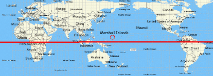
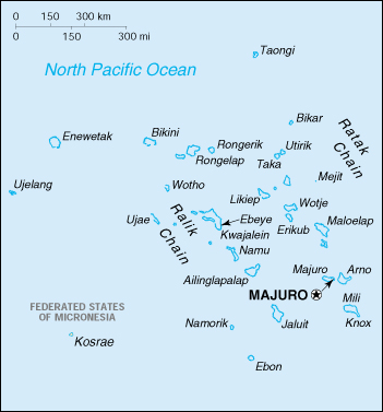
The Marshall Islands are located 2,300 miles south of Hawaii, 15 hours of flying time from Chicago and an average travel time of 32 hours with layovers. In short, it’s a long way from the Midwest portion of the United States. They consist of 29 atolls and five islands that run along the remnants of 2 volcano chains. These volcano chains are called the Ratak and Ralik chains. Millions of years ago the volcanoes along those chains formed, erupting until they were high above the sea. Then, hundreds of thousands of years later they stopped erupting and began to sink back into the sea. As the volcanoes were sinking below the surface of the water, coral began to grow upward towards the sunlight and out toward the waves. This formed the rings of coral creating 29 atolls that make up the Marshall Islands. The Marshall Island territory is made up of 750,000 square miles of water and 70 square miles of land. It gives us a sense of awe that they were not only found by other civilizations, but people continually traveled to them without getting lost in the immense Pacific Ocean. As of 2011 there were around 53,158 people living on the Marshall Islands. According to the 2010 census there were 22,434 Marshallese people living in the United States. Wikipedia states that as many as 12,000 live in Arkansas, working at the Tyson Chicken Processing Plant, with the remaining large portions living in Washington and California. |
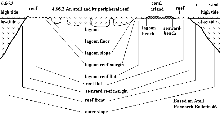
Cross Section of an atoll. There is very little room for sandy beaches because the coral reef begins at the waters edge.
|
Origin of the Marshallese People
Humans began settling on the Marshall Islands somewhere in the 2nd millennium BC. These early explorer/settlers most likely began in Taiwan in 50,000-25,000 BC and slowly worked to Southeast Asia including Australia and New Guinea. Imagine these early settlers drifting off on crafts no bigger than small rafts in the huge ocean. These rafts would carry whole familes, plants and animals, and everything needed to begin a new life in a new location. The earliest inhabitants of the Marshall Islands lived without disruption for nearly 2,000 years before being re-discovered by European map makers in 1529. The islands are named after Captain William Marshall, commander of the Scarborough, who re-discovered many of the southeastern atolls.
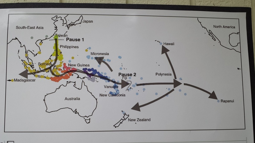
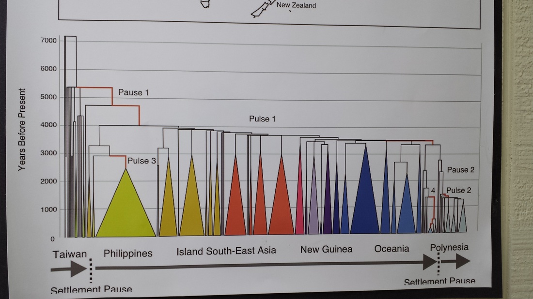
Match the color coating with the map above to follow the migration from Taiwan.
Nuclear Testing in the Marshall Islands
|
The northern atolls were used by the United States as nuclear bomb testing sites from 1946 to 1958. In total, the U.S. tested 67 nuclear weapons in the Marshall Islands. All of this testing and nuclear pollution caused the United States Atomic Energy Commission in 1956 to call the Marshall Islands "by far the most contaminated place in the world".
After a bomb test in 1954 that was nicknamed BRAVO (it was 1000 times more powerful than the bombs dropped on Japan in WWII), residents of Bikini Atoll (where the name for the swim garment came from) were forced to move to other atolls within the Marshall Islands because the radiation levels were too high for safe living. This bomb was so powerful that white ash from the blast fell on Rongelap Atoll, nearly 125 miles east of Bikini. In the early 1970’s the U.S. government declared the atoll was again safe but movement back was hesitant and slow. The U.S. government conducted annual radiation tests throughout that decade and found that animals such as crabs and fish showed high levels of radiation. The people who moved back to the atoll also began to show signs of radiation poisoning. In 1978 residents were again forced to move off the atoll. From 1956 to August 1998, at least $150 million was paid to the Marshallese Islanders in compensation for their exposure to U.S. nuclear testing and lawsuits against the U.S. government are still being fought in the courts. |
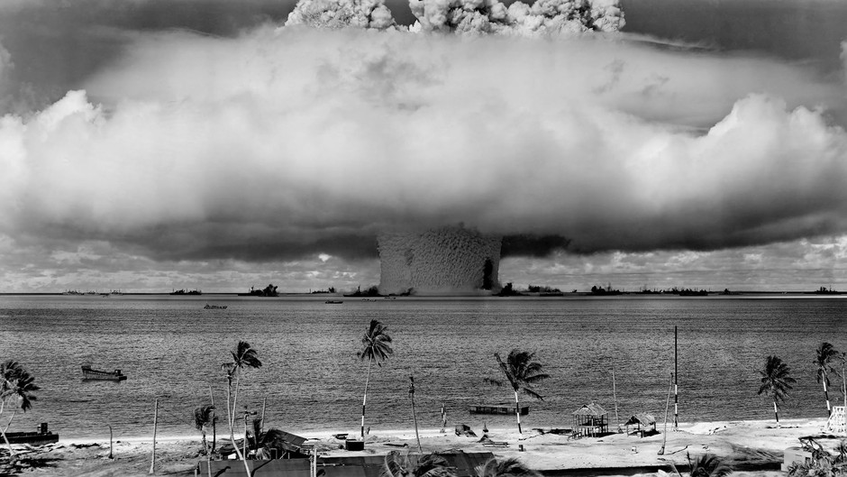
Mushroom cloud from one of the nuclear bomb tests on Bikini Atoll
|
Marshall Islands Independence
|
During WWII, Japan invaded the Marshall Islands and set up operation bases because of its proximity to Hawaii. It was their desire to capture all the islands in the South Pacific. When the United States took the Marshall Islands from the Japanese in 1944, they made them a United Trust Territory. This meant the Government of the Marshall Islands was under United Nations protection while it prepared for self-governing. In 1979, the Government of the Marshall Islands was officially established and the country became self-governing.
“In 1986, the Compact Free Association with the United States entered into force, granting the Republic of the Marshall Islands (RMI) its sovereignty. The Compact provided for aid and U.S. defense of the islands in exchange for continued U.S. military use of the missile testing range at Kwajalein Atoll. The independence procedure was formally completed under international law in 1990, when the UN officially ended the Trusteeship status.” Wikipedia – Marshall Islands |
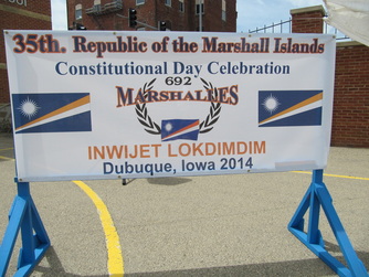
35th Annual Constitution day celebrated at Prescott School, Memorial Day Weekend 2014.
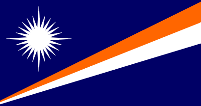
Blue-Ocean, Orange-Bravery, White-Peace.
The top and bottom are separated to show the two volcano chains that make up the Marshall Islands and each point in the star represents an island in the republic.
|
Weather
|
I wanted to write up this section with one word… HOT, but that would be self-serving and not completely descriptive of what the weather is like there. Maybe I could sum it up in three words, Really, Really Hot. Although the average temperature is around 86 degrees Fahrenheit, which isn't all that bad but couple that with the average humidity, which is around 80%, and you can see it gets pretty warm on the Marshall Islands.
I wanted to travel in comfortable clothes on the plane but still have enough clothing on to be warm, after all it was going to be around 34 hours to the islands. I put on my most comfortable jeans and shoes and boarded the plane in Iowa. Imagine 91 degrees and 85% humidity hitting you in the face as you exit the plane on Majuro (kind of like when the Jamaican Bobsled Team exited the Canadian airport terminal in the movie Cool Running’s, but the exact opposite weather conditions). The sun and thick air were relentless the first few days of the trip but once we became acclimated to the heat it was barely noticeable. We started to notice that the majority of men on the island wore pants and many of them were wearing long sleeve shirts. One of the people we met on island, the man who took us around, was a College of the Marshall Island Professor and Majuro native named Wilbert ALIK. In all the times we saw him he never had on less than 3 shirts and a long pair of pants. The rain was not constant, but it was daily and sometimes 2-3 times per day. There would be sunny skies and then 2-3 minutes later it would start to downpour so hard you couldn't see across the street. As quickly as it began, it ended and then it was sunny again. This was a blessing and a curse all in one because before and during the rain it was cool and downright refreshing, but after the rain it was even more humid. Puddles would form and disappear within an hour or two and life went on as it does in the islands. |
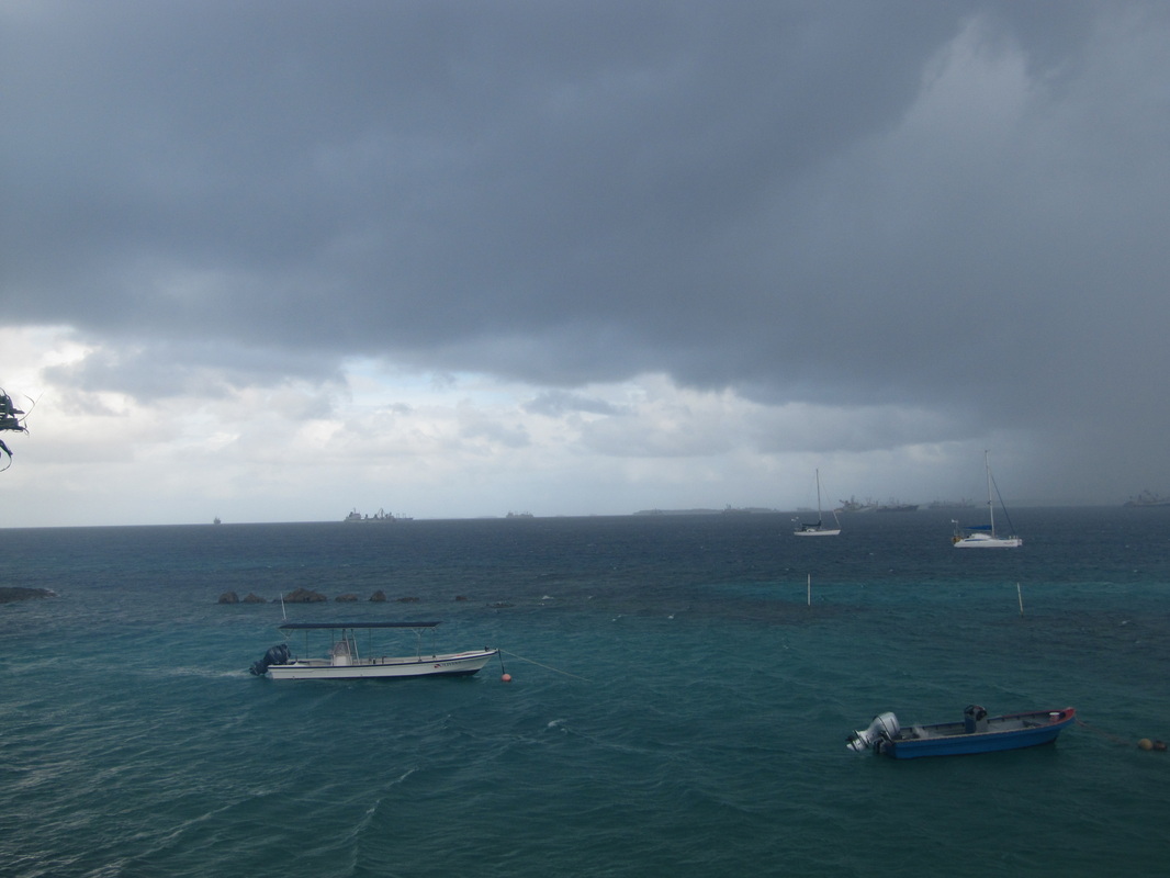
Rain coming in from the right of your screen over the lagoon. Notice the intensity of the rain, we felt very few sprinkles while we were there, only heavy down pours.
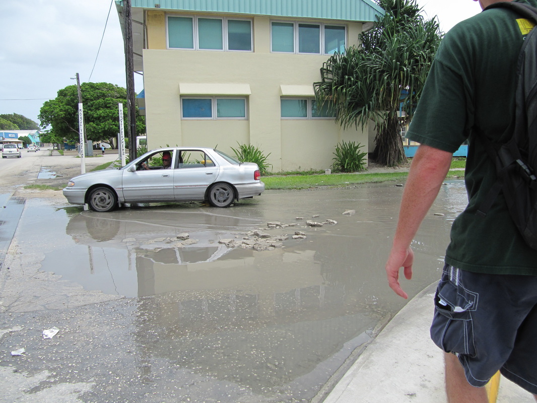
Large puddle left over from the rain, it wold be gone in a little over an hour.
|
